Collection: Processed LiDAR Elevation Data
How to check if LiDAR is available for your desired section(s):
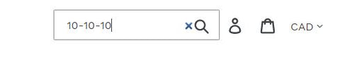
- Click on the magnifying glass icon at the top of the page
- Enter in the legal description in the format 'section-township-range'
- Hit enter or press the magnifying glass icon again to search
-
Manitoba River Lot WERL9 LiDAR Elevation Data for Farm and GIS Software
- Regular price
- $99.00 CAD
- Sale price
- $99.00 CAD
-
Manitoba River Lot WERL8 LiDAR Elevation Data for Farm and GIS Software
- Regular price
- $99.00 CAD
- Sale price
- $99.00 CAD
-
Manitoba River Lot WERL7 LiDAR Elevation Data for Farm and GIS Software
- Regular price
- $99.00 CAD
- Sale price
- $99.00 CAD
-
Manitoba River Lot WERL6 LiDAR Elevation Data for Farm and GIS Software
- Regular price
- $99.00 CAD
- Sale price
- $99.00 CAD
-
Manitoba River Lot WERL5 LiDAR Elevation Data for Farm and GIS Software
- Regular price
- $99.00 CAD
- Sale price
- $99.00 CAD
-
Manitoba River Lot WERL4 LiDAR Elevation Data for Farm and GIS Software
- Regular price
- $99.00 CAD
- Sale price
- $99.00 CAD
-
Manitoba River Lot WERL30 LiDAR Elevation Data for Farm and GIS Software
- Regular price
- $99.00 CAD
- Sale price
- $99.00 CAD
-
Manitoba River Lot WERL3 LiDAR Elevation Data for Farm and GIS Software
- Regular price
- $99.00 CAD
- Sale price
- $99.00 CAD
- Page 1 of 3606
- Next page