Unlimited Access to Manitoba Soils Interactive Mapping
Unlock the full potential of your Manitoba land with our state-of-the-art soil map viewer.
Gain instant access to crucial data like agricultural capability, drainage, texture,
slopes, irrigation suitability, and more. Generate high-resolution map PDFs,
visualize drainage flow routes, and even geolocate directly on the maps using your device.
Perfect for agronomists, assessors, farmers, and land professionals who need to make informed,
data-backed decisions for crop management, land valuation, and sustainable practices.
🎉 How to Unlock Your Premium Content! Once you sign up, head over to the “My Courses” page in your Account Area to access our interactive map and exclusive Soils 101 Lessons.
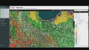
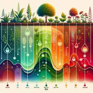
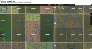
Visualize Soils with Interactive Map Layers
Explore a wide range of detailed layers – from agricultural capability and pH levels to clay content – and gain a deeper insight into Manitoba’s soil health.

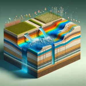
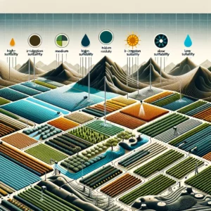
Now with Basic Drainage Flow Mapping
Explore precision agriculture and project planning with our innovative drainage flow routes layer,
essential for Manitoba’s water management. Perfect for farmers, agronomists, and consultants.
Note: Drainage flow routes are view-only and not available for download.
See It In Action
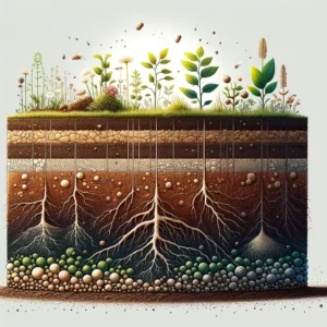
Discover unparalleled Manitoba soil information with our detailed soil map viewer.
Featuring extensive data on soil series, slope characteristics, and water management,
this tool is indispensable for anyone seeking accurate insights into soil composition,
agricultural capability, and land development suitability.
Valuable Applications for Users:
- Precision Agriculture: Utilize Manitoba soil data for tailored farming strategies, efficient irrigation management, and erosion mitigation.
- Sustainable Development: Leverage detailed soil attributes for environmental conservation and land planning.
- Consultancy Services: Offer expert advice on soil management and agricultural assessment to enhance land value and productivity.
- Educational Research: Access comprehensive soil descriptions and classification systems for academic and professional studies.
Learn About Soils: ‘Soils 101’ Lessons
Enhance your understanding of Manitoba’s soils with access to in-depth lessons.
A single click on any soil name within our map viewer opens a searchable PDF with extensive details,
from agronomic properties to environmental characteristics—empowering precise land assessments and strategic planning.